

NIHHIS
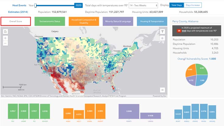
Explore future heat events and social vulnerability in the US on this interactive map tool. Overlay NOAA projected heat events and CDC’s Social Vulnerability Index (SVI) which uses U.S. Census data to determine the social vulnerability of every county. The SVI ranks each county on 15 social factors, including poverty, lack of vehicle access, and crowded housing, and groups them into four related themes.